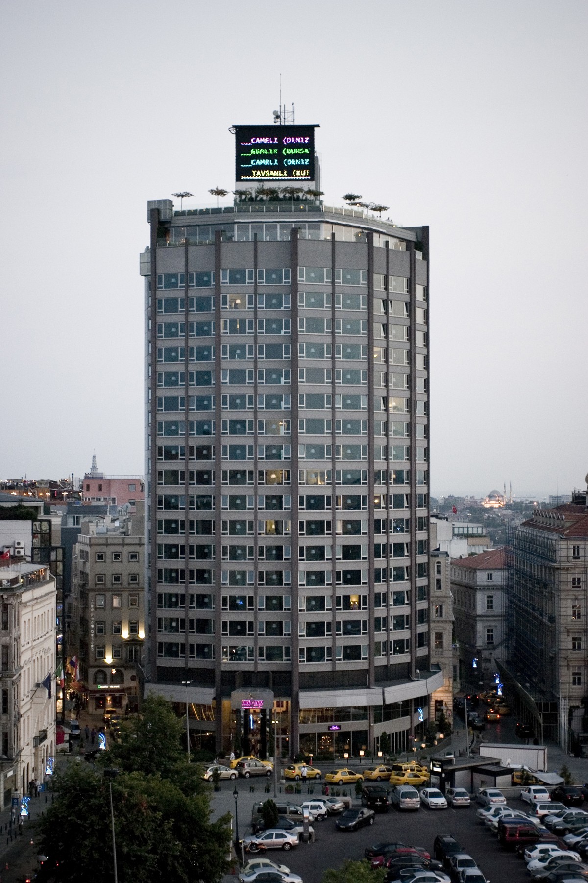
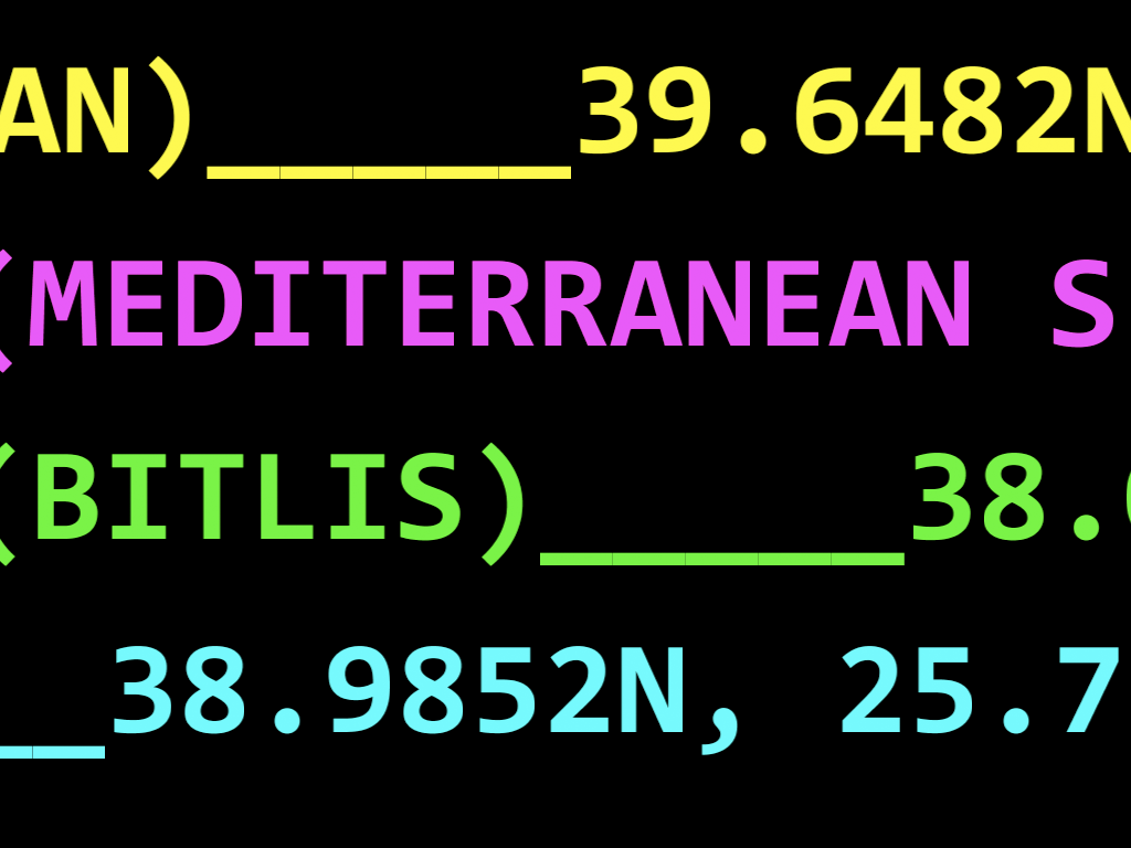
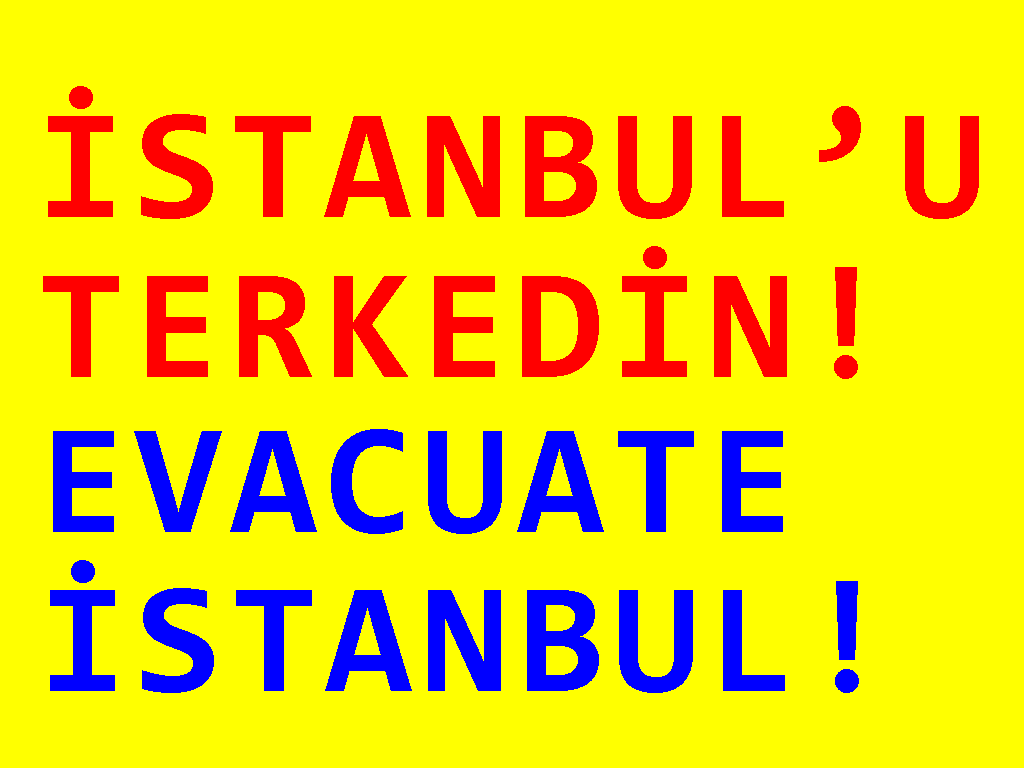
İstanbul –with a rough estimation and miscalculation – is a city of 14 million. e city is situated near the North Anatolian fault line, which runs from northern Anatolia, along the Black Sea coast to the Sea of Marmara. Two tectonic plates, the African and the Eurasian, push against each other here. is fault line has been responsible for several deadly earthquakes in the region throughout history. Every year, under the sea, the southern mass of the fault pushes up from the Arabian Peninsula, with a rapid rupture rate, shifting the northern plate by 2.5cm (one inch) towards Europe. is dead-locked stalemate inevitably reminds us of the dichotomies experienced by the Turkish Republic throughout history. is idea is also well supported with the fact that a prospective earthquake is treated as an earthly activity that can be coped with in human terms like all the others, rather than being a natural disaster. In this context, the earthquake (prospective and happening now) and remote Anatolian locations as real and metaphoric phenomena constitute the content of this show. Minding the delicate relationship between the art and real life on an urban scale, the project builds its visual strategy complying with conventional data visualization methods in an urban context. e project consists of the optimization and visualization of real time data parsed from the website of Kandilli Observatory and Earthquake Research Institute of İstanbul, for a low-res display, like 240×180 pixels. e project made a modest contribution to the everlasting bright lights of Beyoğlu – formerly known as Pera -.